


So much beauty
What to do on vacation in Tirolo, Italy?
Anyone who books accommodation in Merano and its surroundings does not need to worry about boredom on holiday. From the Hotel Kessler in Tirolo, Italy, many natural and cultural beauties as well as the spa town of Merano are even within walking distance. Those who want to be active will find almost infinite opportunities for hiking, cycling, but also for climbing, golf or tennis, and much more. During the winter and Christmas season, on the other hand, a very special magic descends upon the city and countryside.

Untouched nature
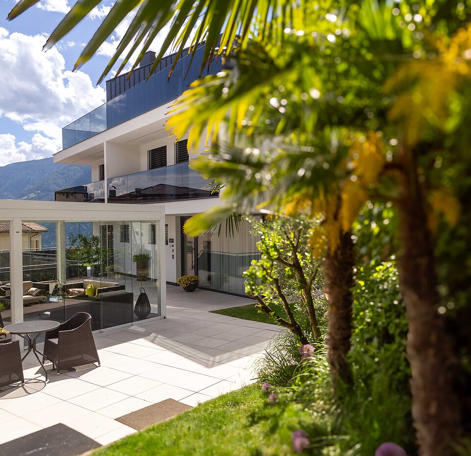
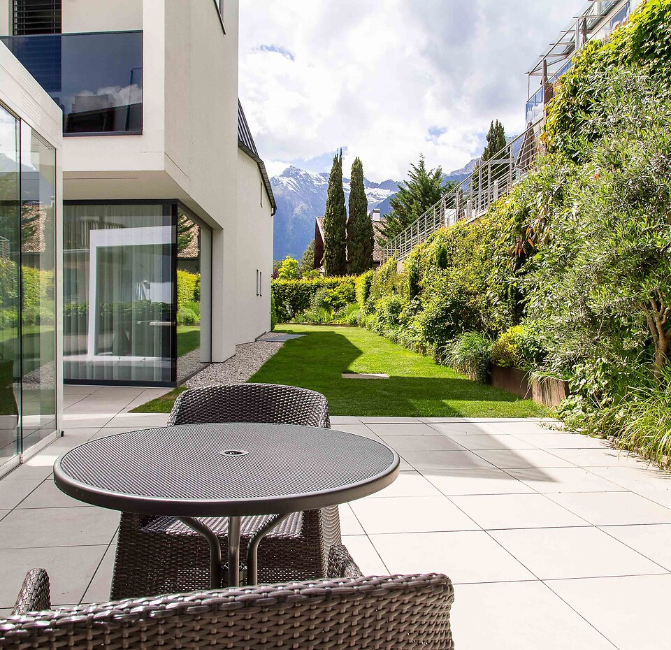
Instantly from the hotel to the outdoors for activities or relaxation

Cosmopolitan city flair
The spa town Meran can be reached in a few minutes.

South Tyrol Guest Pass
Explore all of South Tyrol free of charge with public transportation

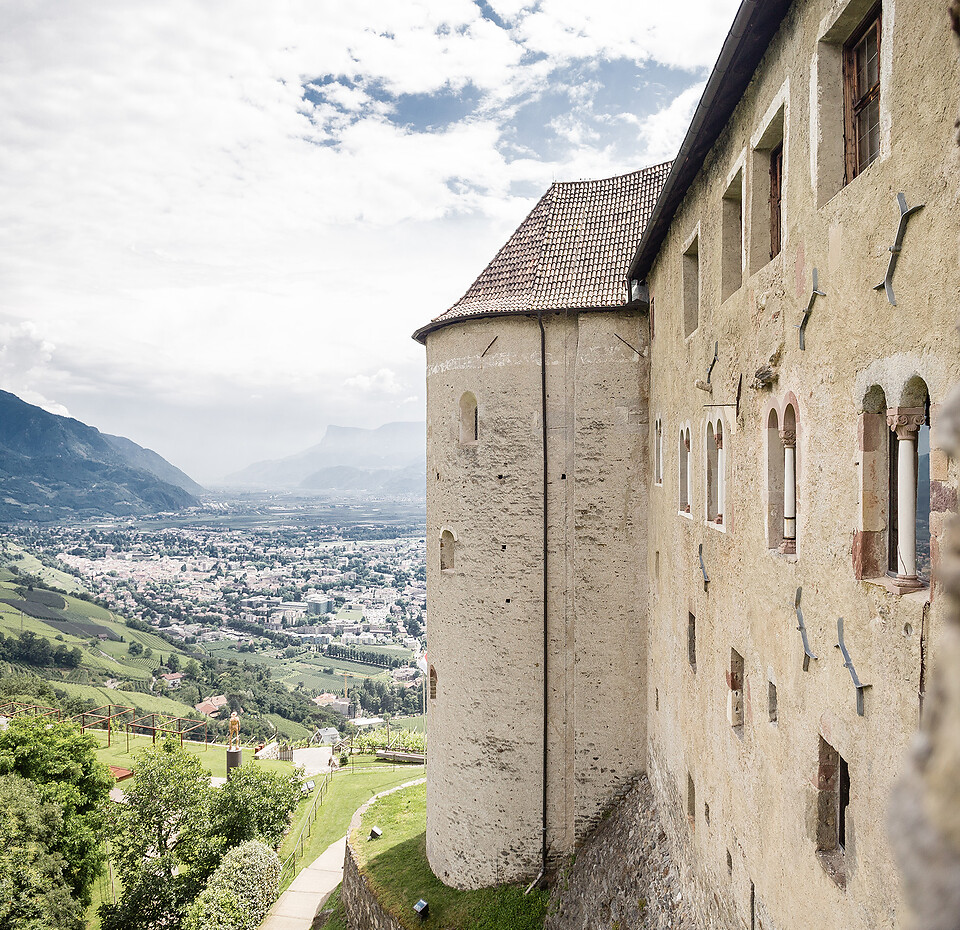
On vacation in Dorf Tirol, Mediterranean flair meets alpine charm. In the village center, palm trees and cypresses grow, while the view extends to the 3,000 m high Texelgruppe Natural Park. The main attractions are Schloss Tirol, the ancestral castle of the Counts of Tyrol, which is now a history and culture museum, as well as the Brunnenburg with the Agricultural Museum.

Even the Austrian Empress appreciated the soothing climate of South Tyrol's second largest city. Take a walk on the famous Tappeinerweg, the Passerpromenade, past the Art Nouveau spa house or through the covered arcade. In the historic arcades, shopping enthusiasts and connoisseurs will find everything their hearts desire. Exciting events such as the Merano Winefestival also take place throughout the year.

Whether on two feet or two wheels - around Meran and Dorf Tirol you will definitely find the right route for your fitness level. Hike between the irrigation trails in the valley, the Meran 2000 hiking area and high-alpine adventures in the Texel Group Nature Park with the Merano high-altitude trail. Cycle over the paved valley bike trails, such as the ancient Via Claudia Augusta, beautiful forest roads or exciting mountain trails.

Garden landscapes from all over the world, spanning over 12 hectares, artist installations and interactive pavilions, observation decks, real animals, the Botanical Underworld, and more can be discovered here. In the summer, the concerts and events at the lily pond also attract music fans. Inside the castle itself, there is a Museum of Tourism History to visit.

Designed in 2005 by star architect Matteo Thun, the new Terme Merano offers a comprehensive bathing and wellness offer: 25 pools, spread over the indoor and outdoor areas, a spacious park, an exclusive sauna landscape, 26 treatment rooms with a diverse range of massages, baths and beauty treatments using high-quality South Tyrolean natural products, as well as a growing health and fitness offer.

When the temperatures drop, the fun begins in the Merano 2000 ski and hiking area. Merano is widely known for its large Christmas market and the festive atmosphere in its richly decorated center. The atmosphere at the Tyrolean Castle Advent at Tyrol Castle is completely different. The Christmas market in the castle courtyard combines concerts, a nativity scene exhibition, and traditional craftsmanship for a relaxed Christmas experience.


